After our morning in Chatanooga, we drove to our next Harvest Host location, Walnut Hollow Ranch, and the most beautiful campsite yet (there are many contenders). We were out in a pasture above the farm buildings next to a lot of curious cows and it was a beautiful day. We bought a lovely steak, some of their bacon and fresh eggs. It was a peaceful night with an almost full moon. The next day we were off to start our journey on the Blue Ridge Parkway
 |
| As you can see it was a beautiful campsite and day at Walnut Hollow Ranch - windy and cold though. We managed to sit out with our drinks in the sun, but bundled up. |
Our next two days on the Blue Ridge Parkway were a study in contrast. Day One was partly cloudy with long-distance views. Day two was pouring rain and fog so thick we could barely see the road at times. Thank goodness for the double yellow line on the road! We probably should have skipped that day but we wanted to drive the whole length (469 miles), come hell or lots of water. In fact, the very first section of the parkway was closed for ice: we entered at milepost 455 so we missed the first 14 miles. We were very lucky to stop at the Visitor's Center in Bryson City and meet an experienced Blue Ridge Parkway traveler who was volunteering there. She looked up closures on the Parkway and sent us on the right route.
 |
| On our route from Chatanooga to Walnut Hollow Ranch we passed huge numbers of rafting companies. This is a big area for rafting and other boating/fishing pastimes. This is the dam at Ocee which does controlled releases for the companies. |
We had really tried to understand the Parkway route from the internet but it isn't shown on Google Maps and trying to put the Parkway on the Google map, when all we had was a route shown it by itself, was impossible. The paper strip map we got in Bryson City was a godsend. Traveling it at this time of year has the positive element of little traffic. The overlooks were mostly empty and easy for us to pull right in with the trailer. During busy times, it would be impossible for us to do this, except for really large parking areas, which were few. But almost all of the Visitor Centers, Campgrounds, and Museums were closed until early May. It was a challenge finding RV campsites near the Parkway.
 |
| A view showing the road off in the distance and as you can see, mostly cloudy |
As we climbed up to the start on Route 19 the clouds grew denser. As you can see from the photos it was mostly cloudy and cold (we saw 37 degrees at one point). This section is the most remote and up the highest (6053 feet). The visibility was excellent.. The Visitor's Center at Waterrock Knob was open and we were able to get coffee at the restaurant on Mt. Pisgah, which is a full-service Hotel.
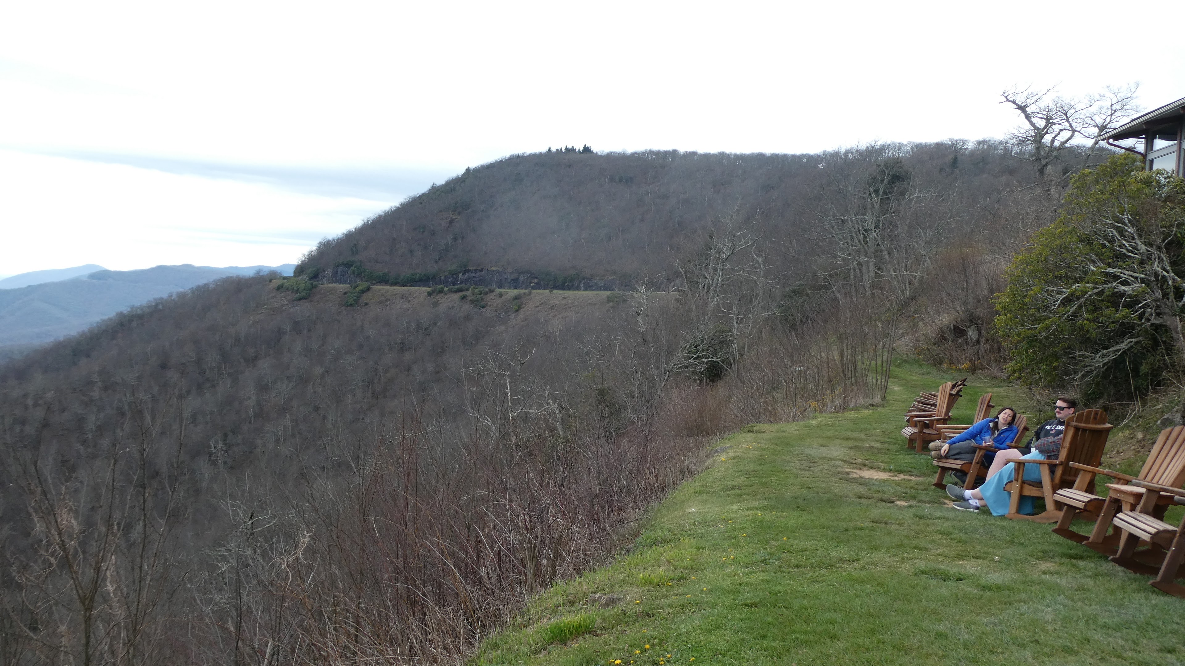 |
| We sat out on these chairs having our coffee in front of the Mt. Pisgah Hotel. |
Before we got up on the Parkway, we found a KOA campground in Asheville for that night. In the past, we've always made reservations in advance but we simply didn't understand what was involved in this endeavor so waited. This was the closest place we could find, others, more attractive, were full. The next morning after making a reservation for that night at the Linville Falls RV Park, we were back on the Parkway and the rain started. And the clouds rolled in. And the fog descended. I averaged 25 miles an hour for too many hours. But there was one bright spot in our day - the Folk Art Center. It was open and we enjoyed hours there viewing their permanent collection and the amazing array of art and crafts at the Southern Highland Craft Guild Shop, chartered in 1930. Allandstand Cottage, an earlier organization was established in 1897 by Frances Goodrich, to encourage and assist local craftspersons in the area.
 |
| A look at one section of the Guild's gallery and shop. |
It was only a short but narrow road down off the Parkway to the Linville Falls RV Park - nestled in the woods and would be rather charming in other than pouring rain. The sites were small and it took us a while to back into our spot but finally, we hooked up to the electricity and settled in for the windy rainy night in our cozy Baby. The next morning the rain stopped and we headed back up on the Parkway - more in my next post.
 |
| The cows at Walnut Hollow really found us rather fascinating - lots of calves. |
 |
| We hiked into a viewpoint to these falls. There are hiking trails everywhere and they are well marked. |
 |
| I'm wearing a turtleneck, vest and rain jacket. We started out in December with hats and gloves but now can't find them. |
 |
| We hiked up to Waterrock Knob viewpoint and on the way passed the Mountains to Sea Trail (1175 miles from the Smoky Mts to the Outer Banks |
 |
| Scott did a number of these Panorama shots |
 |
| As you can see it was cloudy but good visability |
 |
| There were a lot of tunnels. Luckily the lowest height one was in the section we missed - it would have meant staying to the middle of the tunnel. |
 |
| Raku Artist Lylnn N. Jenkins was giving demonstrations at the Folk Art Cener |
 |
| This is the only photo I was able to take outdoors on our second day on the Parkway. After this the rain was so hard and the fog too deep. |
 |
| Our campsite at Linville Falls RV center the next morning when the rain stopped. YEH~ |


No comments:
Post a Comment