 |
This sea plane landed and took off in the mooring field. I looked
up at some noise and saw the plane go by our window! |
 |
This bird has evidently been fed a lot as he hung
around us expecting a hand out |
We left Alan's Cay in the morning and motored down to Warderick Wells. The procedure to get mooring allocations is this. Every day at 9AM the Park Warden comes on VHF 16 and asks you to switch to 9 if you want space. She then lists the boats on the list for that morning and follows by asking for any others. You say your boat name and when recognized give your boat name, length, draft and whether you want today or tomorrow and where you want to go. There are 3 locations; north, south and Emerald rock. North is my favorite; near the park headquarters and beautiful. South is lovely too but most boats other than very shallow draft need to exit the banks and reenter there. It is also far away from anything. Emerald rock is on the banks and more open. It isn't far to dinghy to the headquarters and has great snorkeling with lovely beaches nearby.
 |
Park headquarters dock. Doesn't the dinghy look like it's
floating in space? |
After she takes down all the names, she goes off line for awhile to assign spaces. When she comes back on she gives out the mooring assignments for that day. We had called yesterday so we were on the list for that day. We lucked out and all snagged north mooring locations.
The Exuma Cays Land and Sea Parks was created in 1959. It consists of 179 square mile area from Wax Cay Cut to Conch Cut and includes 15 large islands and many small ones. Some of these were privately owned before and are being developed but are hopefully environmentally sound.
 |
The beach near the park headquarters with picnic tables
and free kyacks for day use |
Warderick Wells is the headquarters for the park. This was our third time here. The first time we anchored off Emerald Rock (that is still possible outside the mooring field) and the second time had #2 mooring in the north field for only one night. That was last spring when the weather changed and we had to leave for our crossing to Florida earlier than expected. So we were really looking forward to 3 nights here (although we would love to spend weeks).
The hiking is great with many trails available. Boo Boo Hill is such fun with it's cruiser memorial signs piled up at the top. A side trail to the blow holes is interesting and beautiful too. Continuing on past the memorial cairn the trail goes down the east side for awhile before turning over Hutia Hill to the Causeway Trail, over the bridge and back to the start.
The next day we hiked the length of the island down to the southern Hog Cay mooring field. This is a hot and tiring walk (but so beautiful and worth it) taking over 2 hours not stopping, so we recommend having someone pick you up at the other end in a dinghy. Years ago we walked both ways with our son and it was a full day (bring lots of water and food). This time Marie and Ron drove 2 dinghies down for us with water and snacks. We swam and lay on the beach for awhile and then snorkeled around Emerald Rock on the way back. There are lots of snorkeling sites identified on the park maps.
 |
The walk down to the Blow Holes diverts from the Boo Boo
Hill trail. Eerie noises and sometimes spouts of water come up
from them. |
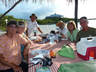
The last night a pot luck on the beach gathered steam when some other friends joined us that had just arrived. Some of us met early at the picnic tables (under a roof) on "Powerful" beach to play dominos and then everyone came for dinner. Kevin on Vagabundo, Jim and Nancy on Amata Marie, and Mike and Sandy on Chinook joined us. We had an unusually elegant meal - green chili fish canapes, olive bread with tapanade, cheese and crackers, Jambalaya, chicken quesadillas, roasted vegetables, roasted pork tenderloin with polenta balls AND a gingerbread cake for dessert. Pretty amazing, huh?
The next day we were off for our next adventure - James Bond's Thunderball Cavern and Staniel Cay!
 |
| The view over the northeast mooring field from the blow holes |
 |
That's Heather at the bottom of a deep hole
and the steep ladder she used to get there |
 |
| Top of Boo Boo Hill with boat signs left by countless cruisers |
 |
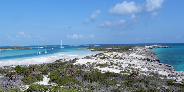
| View over the lagoon and Emerald rock in the distance |
 |
| Peter and Kristian approaching the bridge |
 |
Julie on the trail to the south
end of Warderick Wells |
 |
We passed a lot of beautiful beaches as we hiked down the
island. |
 |
The trail is shown here in the bottom right hand corner. It's
on hard coral so be sure to wear good shoes! |
 |
| Peter, Julie and Kristian at the Pot Luck |
 |
| Elegant dining on the beach |


No comments:
Post a Comment