Wednesday, April 05, 2023

Capitol Reef National Park

The distant mountains were snow covered but the valley was much warmer. 
Even in winter the orchards are beautiful but we would love to see them in the Spring flowering and in the fall heavy with fruit. Visitors can pick fruit themselves then!

We knew nothing about this park before we arrived, When we came out to Utah 30 years ago we did the usual 5 big parks and most people we know have done the same. So it was a lovely surprise. The general look is like Zion and Bryce - towering multi color cliffs and hoodoos - but the verdant orchard valley was really beautiful and unique. The Park is about 60 miles long and around 6 miles across, a rocky spine (Water Pocket Fold) formed by the Fremont River. Originally named Wayne's Wonderland by local boosters it became a national monument in 1937 but it wasn't until Route 28 was built through the park that it took off. Congress finally made it a National Park in 1971 
Many of the formations have been named, This is the Fluted Wall. I remarked to Scott when viewing one area and said it looked like the temples along the Nile. Then we got to the sign saying it was  Egyptian Temples.
The first settlers came after the Civil War when the Mormon Church sent pilgrims west to settle new lands. They established what is now known as Fruita in the 1880's and planted the beautiful orchards that line the river through the park and are still productive. By 1920 only 10 families remained and they eventually left. An early 1900's uranium mine was taken over by the government when it became public land and briefly was revived during WWII, but it was not successful.
The colors are wonderful.

We settled Baby in Loa, about 30 minutes away, at Noon and spent the afternoon exploring the park. It was a beautiful day but windy. We knew the weather would go downhill the next day so really did a lot of exploring that afternoon. The 7 mile "Scenic Drive" is a paved road through the park (not Route 28, which is also scenic and which we took two days later to Moab). There are a number of narrow dirt roads that extend off that are occasionally off limits, But there hadn't been a lot of rain so we were able to explore several of them. The first was to a viewpoint overlooking Gooseneck Canyon, which has formed what is known as an "entrenched meander", in which the canyon-cutting stream creates a bend so tight it nearly doubles back on itself.

I'm sure glad I have a variety of layers to wear. At this point I have 3 on; turtleneck, flannel lined shirt and down vest. Sometimes I wear my rain jacket over all that. I have 2 other fleeces as well. 
Looking down into Gooseneck Canyon from our hike

You can see one of the several bends in the canyon here. The snow covered mountains were much clearer to us than the photos show.
The second more challenging dirt track is at the end of the Scenic Drive and winds through narrow gorges where oncoming cars need to wait for each other at good spots. At the end was the Capitol Gorge trail that leads to some petrographs and water depressions used by Native Americans much earlier. We stopped at the Visitor's Center to talk to a Ranger - always helpful and fun. He recommended we see the restored settler's cabin Gifford's Homestead for some pie! Originally settled by polygamist Calvin Pendleton in 1908 it eventually passed to the Gifford family who lived there from 1928 to 1969 and ran a small motel for visitors. Carrying on their tradition of baking, today the Capitol Reef National Historic Commission makes over 300 pies each day (and a few other goodies) which are sold out by Noon. We got two of them - apple and cherry and they were amazing! We ate one right outside on a picnic table (they are small, perfect for two). 
Horses, barn and farm machines from the 
past are still around.

This is the Gifford's Homestead. It is now a small
museum, shop and bakery!


On the way back to our RV we stopped at many spots to take photos, made a quick stop at a grocery store, and then settled back home for dinner. I'd made pasta with sausages and veggies the night before so an easy meal with salad. The wind was howling and shook our RV overnight considerably. The next morning after reviewing the weather, we decided to move up to Torrey, the gateway town to Capitol Reef. There was a more attractive RV park there, Thousand Lakes, and more things to do at night. And we were closer to the Park and our eventual trip to Moab. But it was COLD. Leaving Loa the wind chill was at least 0 degrees and Scott had a hard time hitching up Baby and disconnecting from the site. We took it slow as the gusts were up to 50 miles per hour and occasional snow showers. But the new RV park was very nice and we were much closer to the Park. So after lunch, we went back into it and did some hiking around the orchards in Fruita. It was a little more protected there from the wind.

The orchards line both sides of the valley. There wasn't much water in this stream but obviously sometimes it rages. Many signs around the park warn visitors to watch the weather. 

This was our second day in the park and even though we had sunshine, it was very cold due to the high winds and a high temperature of 40. 
There was a great BBQ restaurant right at our RV park so we took out our meals for that night - Ribs, Steak, Grilled Zucchini, "Loaded" Cream Corn and Mashed Potatoes! Yum! Again the wind was howling and I admit I was worried about our plans ahead. We had reservations at Ken's Lake Campground up above Arches for 4 nights - dry camping. I was really worried about our propane heat keeping the place warm in these temperatures. 
Looking down into one of the canyons

Our hike into Capitol Gorge
The next morning Scott went out to start preparing for the trip and everything was frozen. He couldn't dump our grey and black water, although it was full, or fill our empty water tank.  He surprised me by suggesting we forget Ken's and stay in Moab instead.  So we called and reserved 4 nights at the Sun Outdoors RV Downtown - expensive but full hookups. What a relief! And they were very nice - the fellow I talked to was concerned about the quote he had to give me and when we arrived, he had found a way to reduce the price. So we're settled in Moab and grateful to be here!
An Egyptian Temple


Monday, April 03, 2023

Bryce National Park in Winter

We hiked from Sunset Point to Sunrise Point along the Rim. This was about mid way, You can see people up on Sunset Point where we started in the upper right hand corner. 

We couldn't believe how many crazy people went right up to edge to have their photo taken, or take one. This is looking the opposite direction from the photo above.

Back months ago we decided to not stay in Bryce as it was first come/ first serve and we were afraid that there wouldn't be a space.  It was a good decision. Only one loop of the North Campground is open in the winter and there are no hook ups for electricity or water. When the temperatures are below freezing at night we are finding that our propane heat alone is marginal. And the night temperatures were way below freezing.

Here's our campsite at Ruby's - lots of privacy! 

So we had reservations at Ruby's Inn and Campground just outside the park. In 1916 Reuben (Ruby) Syrett and his family established a ranch where the Inn is today. At the same time Forest Supervisor J.W. Humphrey started promoting the scenic wonders of nearby Bryce Canyon. Ruby built a "touring business" taking occasional visitors into the area and in 1919 got permission to build "Tourists Rest" where the Bryce Canyon Lodge is today. But it wasn't until the Union Pacific Railroad built transportation to the Park that tourism took off. In 1923 it was designated a National Monument and later became a National Park in 1928. After 1923 Ruby moved the business back to his Ranch. It's a mega business today! "You can do anything you want (recreation wise) at Ruby's". 

We felt a lot safer when the Rim trail was a little further from the edge. The path was slippery at times so we often walked in the snow.
We had been receiving emails from Ruby's for weeks warning us that they were opening only just before we arrived and that they had much more snow than usual. As a result we changed our reservation (free) for two days later and only 2 nights instead of 4. We added those 2 nights to our time in Page. Great decision as the weather was much better there and we saw a lot more of that area. There was a lot of snow at Bryce and as you can see, we camped in the almost deserted campground - but it was very pretty and there was electricity!
Our first stop was Bryce Point. The footing was 
icy and the railings just above the snow,

Like many others I had to hold onto the railing
when the trail went downhill!


One day was plenty of time to spend at Bryce. All but one of the trails below the rim were closed and some of the Rim trail as well. We hiked everything that was available except that one trail (Queen's Garden). We watched people descending that and unless you had hiking poles and crampons, you were crazy to do it. As it is, the Rim trails and access to the viewpoints were icy and at times I had to bend down to hold onto the tops (only part visible) of the railings or we kept to the deeper snow on the side. 

The view over that railing - seen in the photos above.

The Bryce Canyon Lodge was still closed for the winter as was the Shuttle Service. We had a very nice buffet lunch at Ruby's and swam in their big indoor pool in the afternoon. That was marginal as we shared the pool with a huge number of children. The hot tub looked like one of the circus cars where 20 clowns come out of a Volkswagen bug. But between that and the exercise room, it was a nice change. 

At the end of the Rim Trail at Sunrise Point, we looked back at Sunset Point and even though this is taken with Scott's camera and he zoomed in a little, that group of black bumps on the top cliff are people.
The weather ahead had us concerned. There were winter storm and high wind warning for the next few days. We had reservations in Capitol Reef National Park for two nights and decided to give those up and stay at a RV park nearby with electricity to be sure to stay warm, The road to the first one in Loa, Utah was really interesting: Route 62 north through Antimony. We passed through so many climate zones and so few dwellings. I think in the first 60 miles we only saw two cars. The first settlers came to Antimony in 1873 and named it Coyote. When antimony was discovered there in 1880 it became a mining town and renamed itself. The population at the last census was 122. But Antimony is known throughout Utah for it's Fourth of July fireworks display, which consists of three bottle rockets and free sparklers for anyone over the age of 3. They show the fireworks over nearby Otter Creek Reservoir. We stopped at the State Park there for a short hike along the water - lovely spot and from the number of fisherpeople along the shore - great fishing, Scott finds out so many interesting things during our trip with his phone! Basically I drive 90% of the time by choice. I enjoy driving and Scott's a great navigator. 

The Fremont River RV campground was very basic but the electricity was really welcome. We left Baby there early at 11:00 AM and headed into Capitol Reef State Park for the afternoon. More on that in my next post!

There are a lot of ravens year round at Bryce. They establish and protect temporary territories to compete for handouts by tourists. This photo and the ones below are all Scott's. He was fascinated by the shapes of the hoodoos, 


Zion to Bryce in Photos


We left Zion at 9:15 AM with partly cloudy skies and a scattering of snow on the mountains and a thankfully dry road. There was a long line of cars waiting to get through the Park gate. The road goes right through Zion National Park

In the middle of the drive we go through a 1.1 mile tunnel. RVs need a special $15 permit as they need to stop oncoming traffic while we go through the tunnel in the dead center. The tunnel, built completed in 1930 has a series of "galleries" (windows) and you can see one in the center of the photo above.

As we approach the tunnel, the higher mountains are showing more snow.

Scott took this in the tunnel with one of the 
windows shedding light ahead.

Coming to the end of the tunnel

At this altitude the trees are frosted with snow and cliffs are rising on both sides of the road.
Now the snow is getting heavier and piled up along the road, which is still dry.
This is called the Checkerboard Mesa for the pattern of the rocks.
You can see the pattern clearly here. That's Baby & Junior
We're almost at Bryce now and definitely in the snow. We loved these short tunnels!
At Bryce Point and obviously happy to be there. More on Bryce in my next post!

Friday, March 31, 2023

Final Days at Zion

The Riverside trail is mostly paved and hugs
the Virgin River, sometimes along the cliff and
other times right next to the river,

We watched several groups of 
hikers wade up the Narrows, most
of them with guides.

We walked up the official trail and then on the way back took the sandy path along the river when it was available. The weather stayed nice that morning although it was too early for the sun to make it down to us

As we expected the weather changed over our last two days. On Wednesday we started out with clear skies very early. After full city buses and long line at the Zion shuttle the day before, we decided to go up to the Zion Lodge and have breakfast. And it was an excellent breakfast, a buffet with tons of choices. We lingered over our coffee but still were ahead of the crowds on the Riverside trail. We did this one our first afternoon but so late we didn't finish it. This time we enjoyed the full length and spent time watching the intrepid hikers head up the Narrows in the freezing water.

Taking a break next to the river. 

There were a lot of families here this week, not
sure why. But this little fellow had a tiring day
but a good place to take a nap,

The cliffs go straight up from the
path, Here water seeps out from the
rock


We were back at Baby in time for a late lunch and some errands in town. Well, at least we planned to finish them in town. But no one there could fill or exchange our propane tank, so we had to drive to Hurricane, 20 miles away to do it. The scenery was nice along the way with a lot of big expensive homes. The sky had clouded up with light showers. We also filled up our refrigerator at several stores. As usual, we won't go hungry.

Thursday morning looking back at Baby & Junior (black truck),

The Temple of Shinawava shuttle stop in the snow.

Looking out our window at Zion Lodge

Scott at our table for lunch at Zion lodge
That night it poured most of the evening and it was socked in that Thursday morning. Clouds hung around the mountains. It was so atmospheric we decided to take the shuttle up and around the valley to admire it. As we headed up the mountain the showers turned into hail and then snow. At the last stop we got out to take photos but it was freezing so we hopped back on the down shuttle. The bus stops at every station and at #6 Zion Lodge it came to a halt. Our driver informed us that the shuttles coming up the mountain were unable to continue past #3 due to icing on the road. We would be stuck on the bus for some indeterminate time. Well, it was cold and crowded, so we promptly exited and headed for the restaurant. Just in time because everyone else got the same idea over the next hour. We were comfortable and happy having first coffee and then when lunch service began, an excellent lunch. Downstairs in the lobby every surface was covered with people waiting for the shuttles to begin again. And they did after an hour or so, gradually. 
The view from the Zion Lodge shuttle stop as we headed down finally.

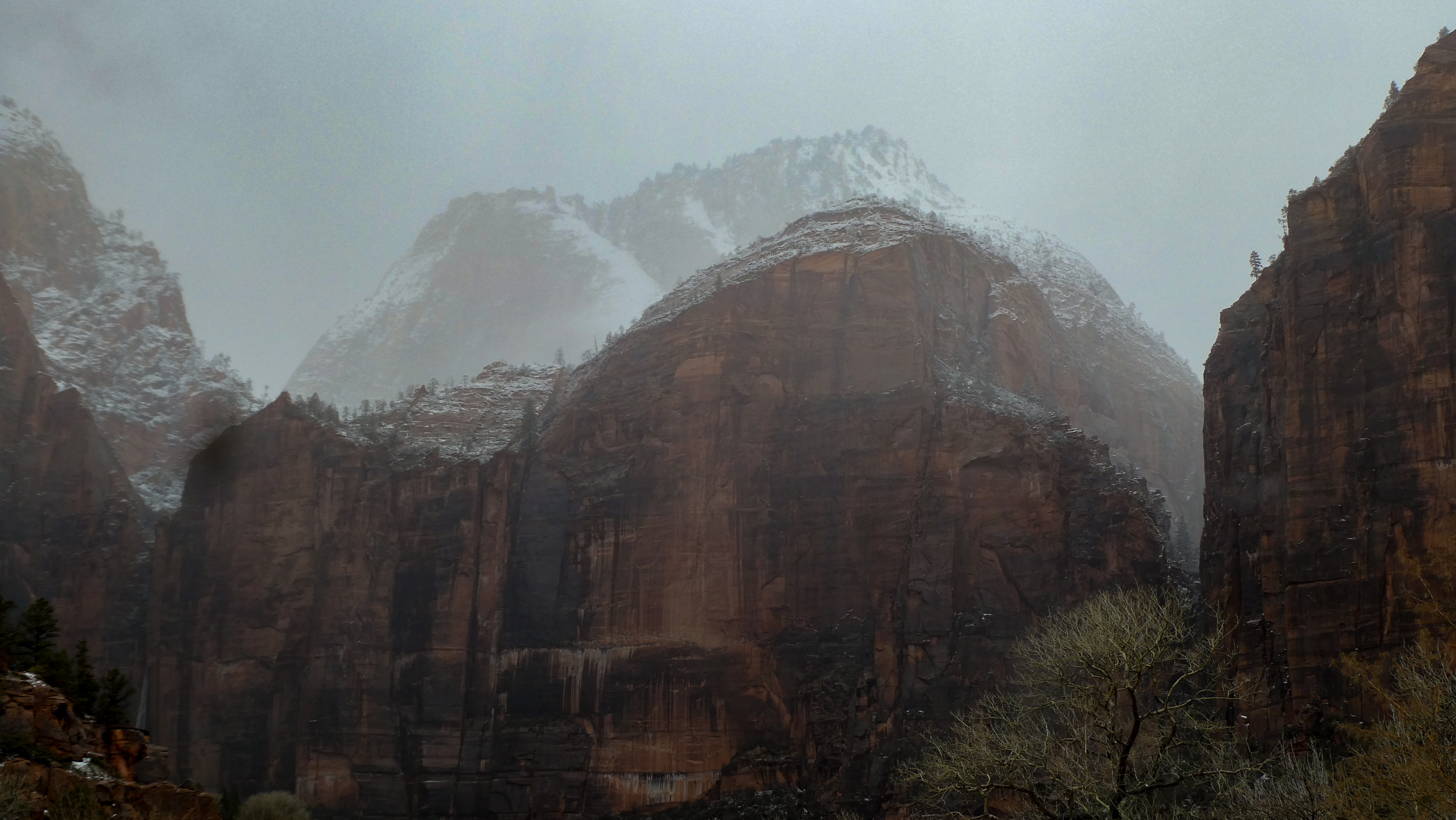
Scott took this atmospheric shot of the old cottonwood in front of the Lodge

And this one of the distant mountains appearing through the mist,.

That evening we treated ourselves to another meal out, at Oscar's Café, highly rated on TripAdvisor. And it may be nice sometimes but didn't work for us. It's set up for nice weather with mostly outdoor seating (under heaters but everyone there was in their parkas and hats!). We sat inside but it was cold and so was our food. It's a Mexican/Southwestern restaurant so we ordered Margaritas. I didn't read the fine print - white wine Margaritas! Yiech! They only serve wine and beer, I switched to wine. It took me a while back at our RV to warm up. 

This morning we head off to Bryce and wish us good luck. The weather report says a high of 35 and a low of 9 - but mostly sunny. Neighbors said there is so much snow you can only see the top of the hand rails.

Thursday, March 30, 2023

Zion, With Lots of Pictures


One of the many S curves on the Zion - Mount Carmel Highway

We managed to pull over here for a photo.

We tried to leave Page, AZ early for Zion but forgot that once we crossed the state line into Utah, the clock "sprung" ahead an hour. We were anxious to get in a hike that afternoon as the weather report showed rain 2 days ahead, But we hadn't realized that our route would take us on the Zion - Mount Carmel Highway and through the famous 1.1 mile tunnel. Work on the road began in 1927 and finished in 1930. Vehicles over 11.33 feet in height and/or 7.83 in width need to have a special permit as the road must be closed to allow one way traffic to pass through the tunnel. It costs $15 and is issued at the entrance. Baby just exceeded the width requirement so we waited a while until they stopped traffic coming our way and then we proceeded right down the middle.  That was an adventure!


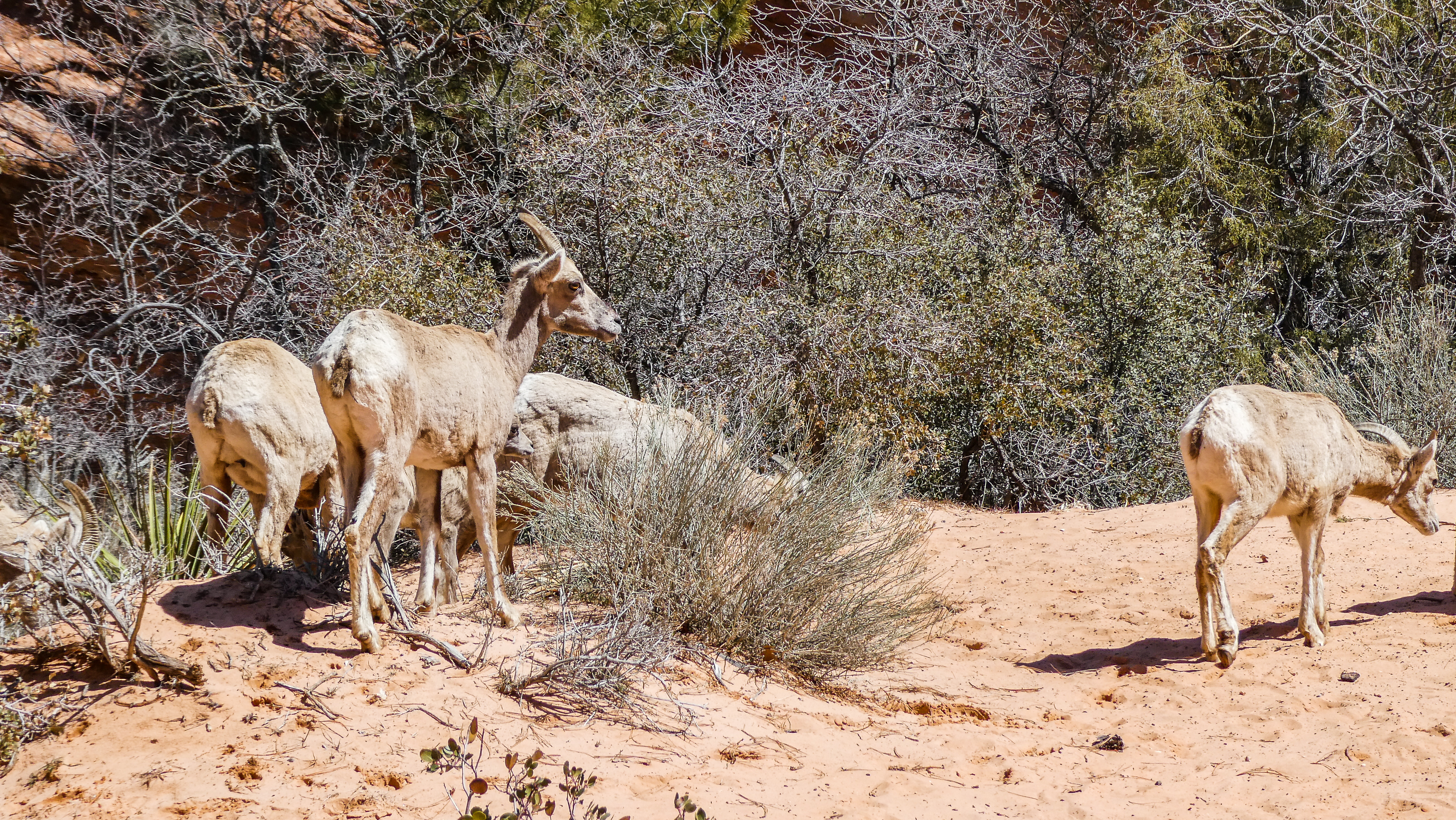
As you can see these goats were not timid!

This is the spot where we found the goats and were able to walk down to the river.

The road itself is glorious with many pull outs to view the scenery. Unfortunately it was a beautiful clear day and there were lots of tourists. We found only a few spots big enough to pull over, but they were wonderful. In one we enjoyed our lunch with an amazing view. At another stop we encountered a band of goats. They were not shy of us but we kept our distance. I had once been butted painfully by one on a small island in the Caribbean and didn't want a repeat.

All the waterfalls were full from the
past week of rain.

This was our first hike up the Riverside Trail
quite late in the day.
But we still managed to get settled in our beautiful RV Park, Zion Canyon RV Resort just outside the park boundaries in time to return for a hike. We took the free Springdale shuttle to the parking lot at the Visitor's Center and then the free shuttle that runs up the Zion Canyon. It takes about 45 minutes to arrive at the last stop, the Temple of Sinawava, the beginning of the Riverside trail. I had read the park map but remembered incorrectly that this was 1.2 miles round trip. We thought that would be perfect as it was already 4:30 PM. But after a half hour of hiking it was clear that I was wrong and it was much longer, so we turned around. But it was so beautiful that we vowed to return and finish the hike into the Narrows another time. In fact we hiked this trail and the Narrows thirty years ago with Scott's brother and his, at that time, partner Katie, but we barely remembered the trip. The weather was very different then, as it was August!
Another view on the Riverside trail which parallels the Virgin River and ends at the Narrows - although we didn't get that far this evening.

We did however get close up and personal with 
some mule deer!
Our RV site was right on the river with a view of the mountains so we enjoyed our drinks outside before moving inside for dinner. It turns cold here as soon as the sun goes down. We got an early start the next morning but even so, the first 2 City shuttles were full, so we ended up walking the 1/2 mile to the Visitor's Center and the Zion shuttle. There were a lot of people ahead of us there but the line moved quickly. Unfortunately when we departed the bus at the Zion Lodge, I forgot my gloves! Despite checking the lost and found several times over the next few days, they were never turned in and I had to buy new ones. 

Our hike this day was the Lower Emerald Pool trail and it was amazing. The crowds were a huge surprise to us though. We thought, being March, that there would few people, but there were lots, particularly tons of families and school groups. But there are a lot of trails. so often we had them to ourselves, at least for awhile. 
The Emerald Pools trail starts by crossing the 
Virgin River,

It climbs up but gradually and was wide,
happily because sometimes it got crowded.

Looking down at the Virgin River from the trail.

Scott looks back just as we start under the 
waterfall

Now we're through the waterfall.

Looking up the valley

Enjoying our drinks at our RV site!

The trail ends at a spectacular waterfall where you can walk behind the falls! We stopped to enjoy the views and take photos, so it was well past lunchtime when we returned. Our RV site is so lovely we just went back and hung out there for the rest of the day. At 5 PM Scott built a fire and we had our drinks and dinner in the last of the sun. 
Scott takes some amazing photos
of birds and other wildlife.

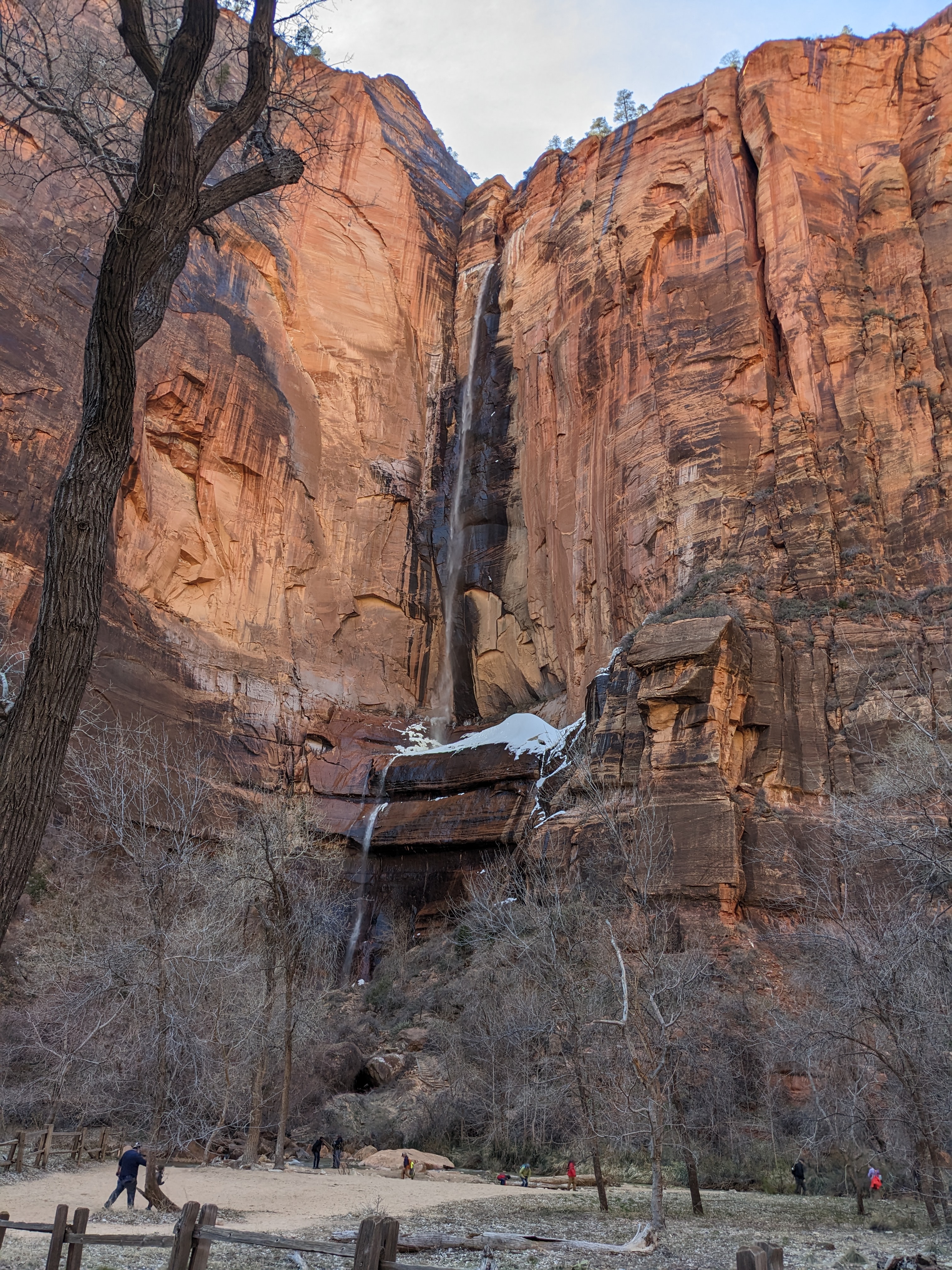
Ice crystals form beneath the waterfall

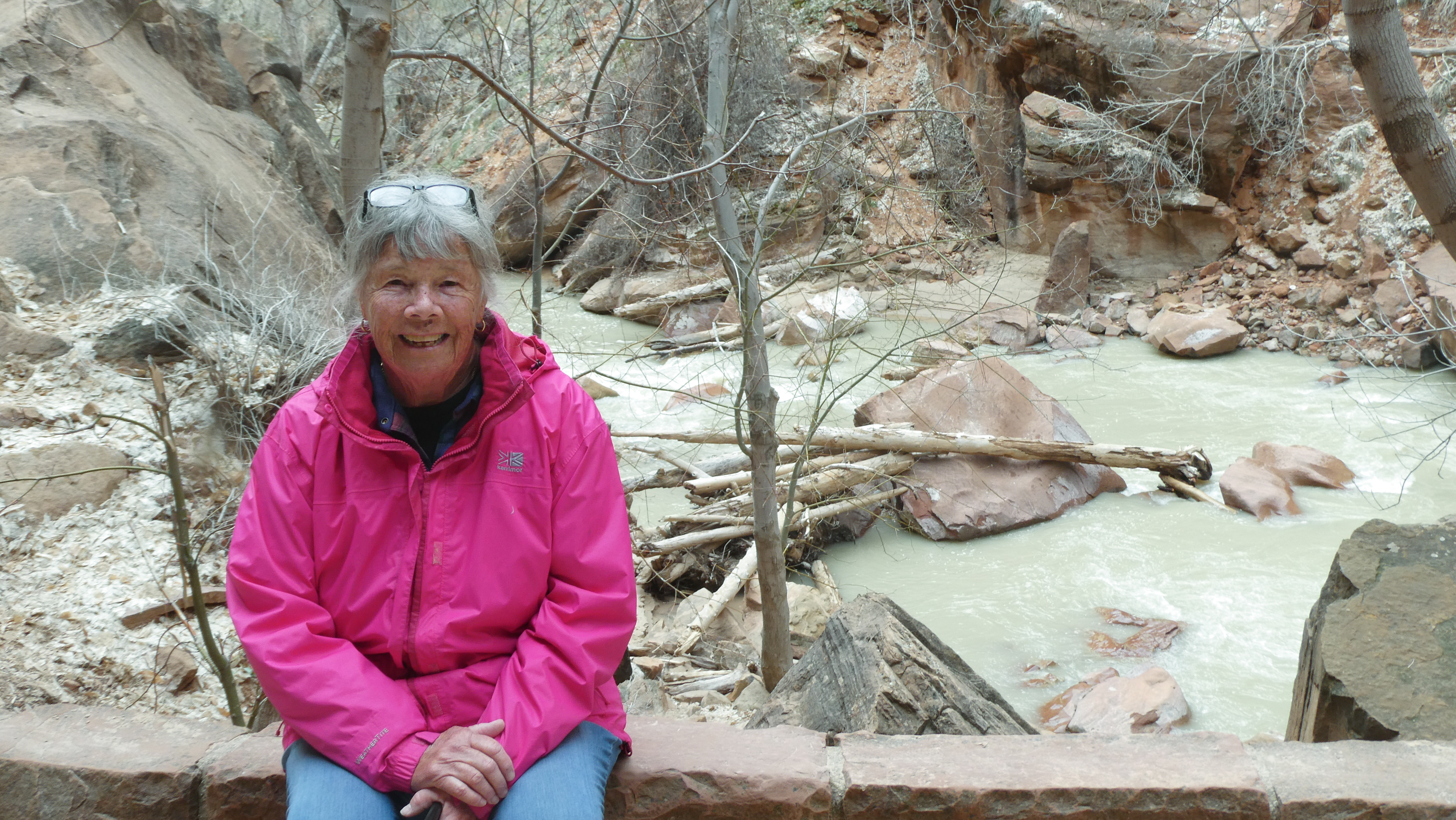
Heather underneath the waterfall in full regalia,
minus gloves.


That's our Baby and Junior in the center at our site in Zion Canyon RV Resort. The Virgin 
River runs behind us.