Showing posts with label Utah. Show all posts

Tuesday, April 11, 2023

A Hair-raising Experience in Canyonlands

This is a professional shot of the top section of the Shafer Road at Canyonlands. 
We had a hair raising experience back country driving in Canyonlands. It put the recent trip in the snow and flooding up from Sedona in the shade and made jumping out of a plane easy peasy (which I did to celebrate my 75th birthday). Yes, I know we promised to be more careful, but the Ranger at the Visitor's Center recommended the Shafer Road and then the Potash one (after asking about our vehicle) and once we started, there was no going back! Literally, as it was so narrow that planning was necessary if another vehicle was spotted coming the opposite direction to allow two cars to pass each other and luckily we were the ones smashed up against the side of the canyon (most of the time). The planning was all our's too, as etiquette demands that the downward vehicle pull off for the upward one. There wasn't a place to turn around until we were at the bottom of the first descent and we sure weren't going back up it. Then the Potash road turned into stream beds at times and we hit bottom (actually I think it was mostly the steps we had installed and the trailer hitch) several times. And it took 2 hours to get through both of them. My hands were cramped from clenching the wheel.
This is my own photo taken from the top of the viewing spot. The section of the road I could see well, here at the top looked pretty good. But it turns out it got much narrower and the edge of the road often dropped straight down. 

This is someone else's photo of the Potash Road, which was wider, longer and much rougher, often in dried up stream beds. We did not take photos during our trip.

"A very famous point of the trail is the Thelma and Louise Point, where they filmed the famous scene in "Thelma & Louise" when they jumped their car off the edge and into the canyon. The final scene is not the Grand Canyon. The view is one of the most photographed scenic vistas in the world. Towering 2,000 feet above the Colorado River, the overlook provides a breathtaking panorama of Canyonlands' sculpted pinnacles and buttes." (taken from a description of the Potash Road online) And this one: "For sections of this road, the surface is a rough worn slickrock and when you drive over it, your entire vehicle will vibrate and rattle like crazy. I would not want to drive my own vehicle on this road!"
View from the Grand View Point trail

Climbing the steep steps on the trail. What a job building this. Most of the work in the parks were done by the CCC back in the 1940's

I'm a bit clautrophobic but have no fear of heights. Nevertheless I don't go nearer than about 5 feet from the edge. That still makes many people nervous and I sure do when I see some crazy, mostly young men, get right to the edge to have their photo taken!

We've been taking a lunch with us and enjoying it at the many picnic spots

Frankly it's hard to take a bad photo and hard to choose which ones to include

We loved looking at the Green River as many years ago we did a rafting trip down it with Scott's brother Brent and his then partner Katie. 

And last of all, a shot that a kind person took for us. You can see that it was cold, even if sunny. 

But we did have some lovely hikes and views before undertaking this exploit. There are 3 sections of the park: Island in the Sky, The Needles and The Maze. We only had time to do the first one. Our first hike was the White Rim Overlook Trail, 1.6 miles along the canyon rim - easy and gorgeous. Then we did the Upheaval Dome second overlook, 1.2 miles but more vertical feet. The upheaval dome is an enigmatic geological structure that has been variously interpreted as a meteorite impact structure or a salt dome.

That's it for this post - next the Colorado National Monument!


Monday, April 10, 2023

Arches National Park


Courthouse Towers

We enjoyed Arches National Park over two days. The first one we spent 5 hours hiking and trying some off road experiences. The second day we came in for most of the afternoon following a morning exploring the bike path along the Colorado River. There was a day in-between, which we spent at Canyonlands and my next blog post will cover that. Arches now requites timed entry planned in advance. Over a month ago we learned this and signed up for 3 days entering at Noon (the first time available on those days). This has been done to resolve problems with overcrowding at the trail heads and view sites (and extensive lines entering the park). It seemed to work well. 

Balance Rock

One of the windows arches, I think Turret

The trails often had stone steps and were easy
to follow, but often steep (I only mind the ups)

I think this is the North and South Windows.


View Sites and Trailheads branch off from the main road throughout the park. We stopped first at Courthouse Towers and Balance Rock where we did a short hikes. Then we did some longer hikes at the Windows Section to see the North & South Windows and Turret Arch. Finally we were on to the Delicate Arch where there were 3 choices. We did the first viewpoint and then up (and up steeply) to the second viewpoint.

It's impossible not to see figures in the stone pillars and mesas. These three women in their long skirts are marching along the cliffs

And here we saw Nefertiti in the center left!

That finished off our hiking for the day so we tried three 4 wheel drive roads. The first was a short bumpy one down the Cache Valley - not bad. The second, a long road down the Salt Valley, was really fairly easy, a lot like a dirt road in Vermont. Buoyed by this success we tried a "rough road" (the Eye of the Whale rod) which they recommended you only do north/south, which was the direction we headed. It quickly turned into a very narrow heavily rutted road, at that point in a deep ditch. There was no place to turn around and then - two jeeps approached us from the opposite direction! Yiech! They stopped and we realized that the downhill vehicle is responsible for getting out of the way. This meant crawling the truck up the side of the ditch. The first jeep pulled up to us and the driver was just inches away from me (we had pulled in our rear view mirrors). He informed us that they had had to turn around due to impossible conditions. He recommended a place a little further down where we could turn around. We did, just barely. What a relief to exit that road! Reading the descriptions of the road later we found that that beginning section was the hardest and if we'd gotten through that, the rest would have been doable. 

That's Scott climbing up the steep trail at Delicate Arch

This was the easy off road trail, down Salt Valley, that led us to try the harder one


The bike path along the Colorado. As you can see it was quite cool early in the morning.

We've been seeing the Colorado all along our trip through Arizona, Utah and now Colorado

Our second day we started off exploring the bike path down the Colorado River on our e-bikes. This is a paved easy bike trail, very scenic. It was perfect for us as we're still a bit nervous on our bikes. Both of us have had falls and are now very careful. Then we went back into Arches for another drive through the park and a hike to the Double Arches in the Window Section. This was a lovely route and finished off the day for us. 

Double Arch

Closer up you can just make out the tiny figures in the center. It gives you an idea of the size here.

We've been enjoying the great restaurant selections in Moab as well. We had breakfast at the Moab Café - excellent, lunch at the Proper Brewery, also great, and dinner at Antica Forma. This last one was unusually authentic Italian. The bread and salad was outstanding as was Scott's pizza. But my linguine with clam sauce could have been served to me in Italy - tons of baby clams and perfect al dente linguine. To me the tip off is not being offered cheese. In Italy cheese is never served with seafood. The owner came over to us to talk and surprisingly, he isn't Italian. But the chef is. My post on Canyonlands will be coming out soon. Big excitement there!


Wednesday, April 05, 2023

Capitol Reef National Park

The distant mountains were snow covered but the valley was much warmer. 
Even in winter the orchards are beautiful but we would love to see them in the Spring flowering and in the fall heavy with fruit. Visitors can pick fruit themselves then!

We knew nothing about this park before we arrived, When we came out to Utah 30 years ago we did the usual 5 big parks and most people we know have done the same. So it was a lovely surprise. The general look is like Zion and Bryce - towering multi color cliffs and hoodoos - but the verdant orchard valley was really beautiful and unique. The Park is about 60 miles long and around 6 miles across, a rocky spine (Water Pocket Fold) formed by the Fremont River. Originally named Wayne's Wonderland by local boosters it became a national monument in 1937 but it wasn't until Route 28 was built through the park that it took off. Congress finally made it a National Park in 1971 
Many of the formations have been named, This is the Fluted Wall. I remarked to Scott when viewing one area and said it looked like the temples along the Nile. Then we got to the sign saying it was  Egyptian Temples.
The first settlers came after the Civil War when the Mormon Church sent pilgrims west to settle new lands. They established what is now known as Fruita in the 1880's and planted the beautiful orchards that line the river through the park and are still productive. By 1920 only 10 families remained and they eventually left. An early 1900's uranium mine was taken over by the government when it became public land and briefly was revived during WWII, but it was not successful.
The colors are wonderful.

We settled Baby in Loa, about 30 minutes away, at Noon and spent the afternoon exploring the park. It was a beautiful day but windy. We knew the weather would go downhill the next day so really did a lot of exploring that afternoon. The 7 mile "Scenic Drive" is a paved road through the park (not Route 28, which is also scenic and which we took two days later to Moab). There are a number of narrow dirt roads that extend off that are occasionally off limits, But there hadn't been a lot of rain so we were able to explore several of them. The first was to a viewpoint overlooking Gooseneck Canyon, which has formed what is known as an "entrenched meander", in which the canyon-cutting stream creates a bend so tight it nearly doubles back on itself.

I'm sure glad I have a variety of layers to wear. At this point I have 3 on; turtleneck, flannel lined shirt and down vest. Sometimes I wear my rain jacket over all that. I have 2 other fleeces as well. 
Looking down into Gooseneck Canyon from our hike

You can see one of the several bends in the canyon here. The snow covered mountains were much clearer to us than the photos show.
The second more challenging dirt track is at the end of the Scenic Drive and winds through narrow gorges where oncoming cars need to wait for each other at good spots. At the end was the Capitol Gorge trail that leads to some petrographs and water depressions used by Native Americans much earlier. We stopped at the Visitor's Center to talk to a Ranger - always helpful and fun. He recommended we see the restored settler's cabin Gifford's Homestead for some pie! Originally settled by polygamist Calvin Pendleton in 1908 it eventually passed to the Gifford family who lived there from 1928 to 1969 and ran a small motel for visitors. Carrying on their tradition of baking, today the Capitol Reef National Historic Commission makes over 300 pies each day (and a few other goodies) which are sold out by Noon. We got two of them - apple and cherry and they were amazing! We ate one right outside on a picnic table (they are small, perfect for two). 
Horses, barn and farm machines from the 
past are still around.

This is the Gifford's Homestead. It is now a small
museum, shop and bakery!


On the way back to our RV we stopped at many spots to take photos, made a quick stop at a grocery store, and then settled back home for dinner. I'd made pasta with sausages and veggies the night before so an easy meal with salad. The wind was howling and shook our RV overnight considerably. The next morning after reviewing the weather, we decided to move up to Torrey, the gateway town to Capitol Reef. There was a more attractive RV park there, Thousand Lakes, and more things to do at night. And we were closer to the Park and our eventual trip to Moab. But it was COLD. Leaving Loa the wind chill was at least 0 degrees and Scott had a hard time hitching up Baby and disconnecting from the site. We took it slow as the gusts were up to 50 miles per hour and occasional snow showers. But the new RV park was very nice and we were much closer to the Park. So after lunch, we went back into it and did some hiking around the orchards in Fruita. It was a little more protected there from the wind.

The orchards line both sides of the valley. There wasn't much water in this stream but obviously sometimes it rages. Many signs around the park warn visitors to watch the weather. 

This was our second day in the park and even though we had sunshine, it was very cold due to the high winds and a high temperature of 40. 
There was a great BBQ restaurant right at our RV park so we took out our meals for that night - Ribs, Steak, Grilled Zucchini, "Loaded" Cream Corn and Mashed Potatoes! Yum! Again the wind was howling and I admit I was worried about our plans ahead. We had reservations at Ken's Lake Campground up above Arches for 4 nights - dry camping. I was really worried about our propane heat keeping the place warm in these temperatures. 
Looking down into one of the canyons

Our hike into Capitol Gorge
The next morning Scott went out to start preparing for the trip and everything was frozen. He couldn't dump our grey and black water, although it was full, or fill our empty water tank.  He surprised me by suggesting we forget Ken's and stay in Moab instead.  So we called and reserved 4 nights at the Sun Outdoors RV Downtown - expensive but full hookups. What a relief! And they were very nice - the fellow I talked to was concerned about the quote he had to give me and when we arrived, he had found a way to reduce the price. So we're settled in Moab and grateful to be here!
An Egyptian Temple


Monday, April 03, 2023

Bryce National Park in Winter

We hiked from Sunset Point to Sunrise Point along the Rim. This was about mid way, You can see people up on Sunset Point where we started in the upper right hand corner. 

We couldn't believe how many crazy people went right up to edge to have their photo taken, or take one. This is looking the opposite direction from the photo above.

Back months ago we decided to not stay in Bryce as it was first come/ first serve and we were afraid that there wouldn't be a space.  It was a good decision. Only one loop of the North Campground is open in the winter and there are no hook ups for electricity or water. When the temperatures are below freezing at night we are finding that our propane heat alone is marginal. And the night temperatures were way below freezing.

Here's our campsite at Ruby's - lots of privacy! 

So we had reservations at Ruby's Inn and Campground just outside the park. In 1916 Reuben (Ruby) Syrett and his family established a ranch where the Inn is today. At the same time Forest Supervisor J.W. Humphrey started promoting the scenic wonders of nearby Bryce Canyon. Ruby built a "touring business" taking occasional visitors into the area and in 1919 got permission to build "Tourists Rest" where the Bryce Canyon Lodge is today. But it wasn't until the Union Pacific Railroad built transportation to the Park that tourism took off. In 1923 it was designated a National Monument and later became a National Park in 1928. After 1923 Ruby moved the business back to his Ranch. It's a mega business today! "You can do anything you want (recreation wise) at Ruby's". 

We felt a lot safer when the Rim trail was a little further from the edge. The path was slippery at times so we often walked in the snow.
We had been receiving emails from Ruby's for weeks warning us that they were opening only just before we arrived and that they had much more snow than usual. As a result we changed our reservation (free) for two days later and only 2 nights instead of 4. We added those 2 nights to our time in Page. Great decision as the weather was much better there and we saw a lot more of that area. There was a lot of snow at Bryce and as you can see, we camped in the almost deserted campground - but it was very pretty and there was electricity!
Our first stop was Bryce Point. The footing was 
icy and the railings just above the snow,

Like many others I had to hold onto the railing
when the trail went downhill!


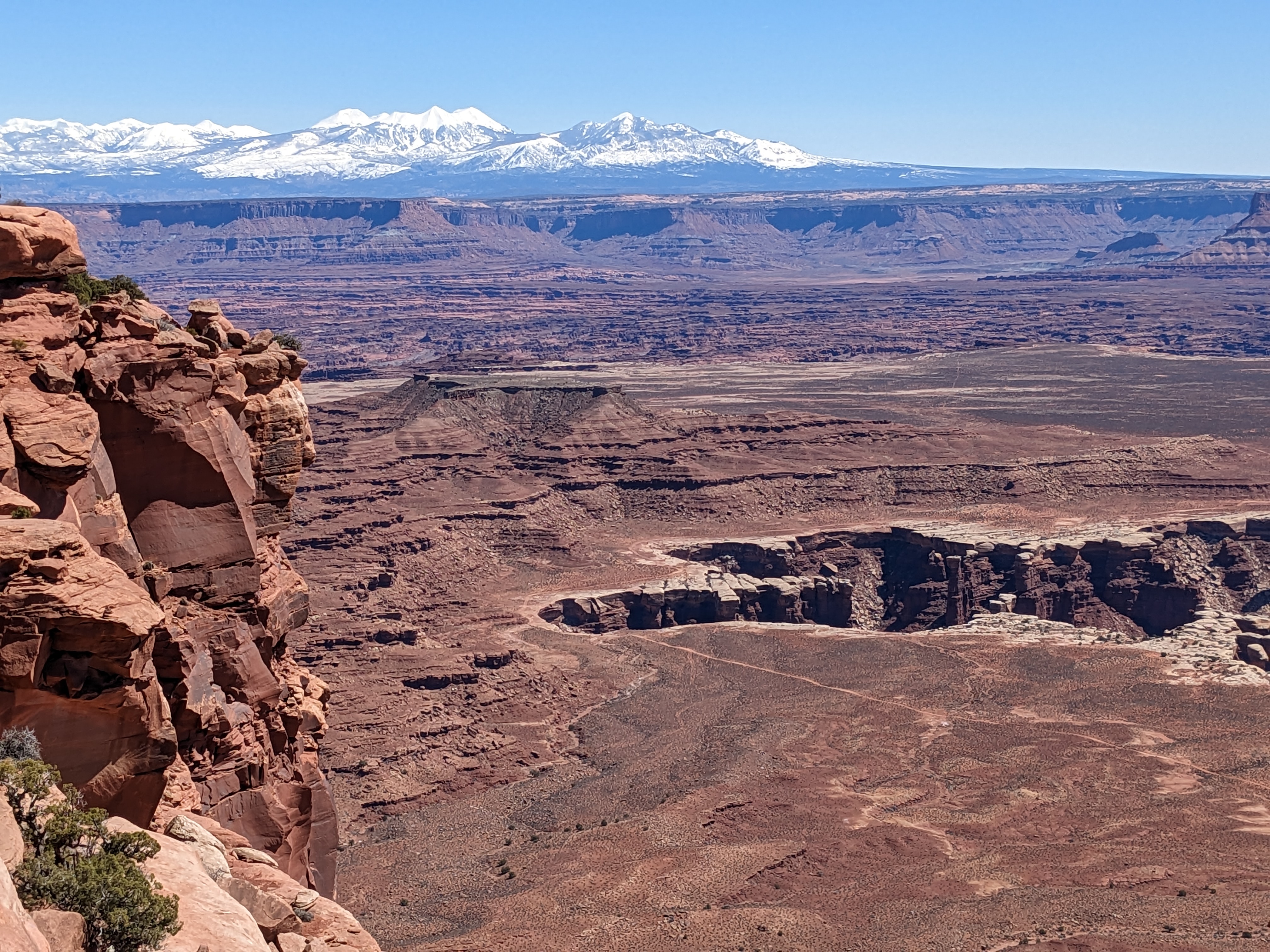
One day was plenty of time to spend at Bryce. All but one of the trails below the rim were closed and some of the Rim trail as well. We hiked everything that was available except that one trail (Queen's Garden). We watched people descending that and unless you had hiking poles and crampons, you were crazy to do it. As it is, the Rim trails and access to the viewpoints were icy and at times I had to bend down to hold onto the tops (only part visible) of the railings or we kept to the deeper snow on the side. 

The view over that railing - seen in the photos above.

The Bryce Canyon Lodge was still closed for the winter as was the Shuttle Service. We had a very nice buffet lunch at Ruby's and swam in their big indoor pool in the afternoon. That was marginal as we shared the pool with a huge number of children. The hot tub looked like one of the circus cars where 20 clowns come out of a Volkswagen bug. But between that and the exercise room, it was a nice change. 

At the end of the Rim Trail at Sunrise Point, we looked back at Sunset Point and even though this is taken with Scott's camera and he zoomed in a little, that group of black bumps on the top cliff are people.
The weather ahead had us concerned. There were winter storm and high wind warning for the next few days. We had reservations in Capitol Reef National Park for two nights and decided to give those up and stay at a RV park nearby with electricity to be sure to stay warm, The road to the first one in Loa, Utah was really interesting: Route 62 north through Antimony. We passed through so many climate zones and so few dwellings. I think in the first 60 miles we only saw two cars. The first settlers came to Antimony in 1873 and named it Coyote. When antimony was discovered there in 1880 it became a mining town and renamed itself. The population at the last census was 122. But Antimony is known throughout Utah for it's Fourth of July fireworks display, which consists of three bottle rockets and free sparklers for anyone over the age of 3. They show the fireworks over nearby Otter Creek Reservoir. We stopped at the State Park there for a short hike along the water - lovely spot and from the number of fisherpeople along the shore - great fishing, Scott finds out so many interesting things during our trip with his phone! Basically I drive 90% of the time by choice. I enjoy driving and Scott's a great navigator. 

The Fremont River RV campground was very basic but the electricity was really welcome. We left Baby there early at 11:00 AM and headed into Capitol Reef State Park for the afternoon. More on that in my next post!

There are a lot of ravens year round at Bryce. They establish and protect temporary territories to compete for handouts by tourists. This photo and the ones below are all Scott's. He was fascinated by the shapes of the hoodoos, 


Zion to Bryce in Photos


We left Zion at 9:15 AM with partly cloudy skies and a scattering of snow on the mountains and a thankfully dry road. There was a long line of cars waiting to get through the Park gate. The road goes right through Zion National Park

In the middle of the drive we go through a 1.1 mile tunnel. RVs need a special $15 permit as they need to stop oncoming traffic while we go through the tunnel in the dead center. The tunnel, built completed in 1930 has a series of "galleries" (windows) and you can see one in the center of the photo above.

As we approach the tunnel, the higher mountains are showing more snow.

Scott took this in the tunnel with one of the 
windows shedding light ahead.

Coming to the end of the tunnel

At this altitude the trees are frosted with snow and cliffs are rising on both sides of the road.
Now the snow is getting heavier and piled up along the road, which is still dry.
This is called the Checkerboard Mesa for the pattern of the rocks.
You can see the pattern clearly here. That's Baby & Junior
We're almost at Bryce now and definitely in the snow. We loved these short tunnels!
At Bryce Point and obviously happy to be there. More on Bryce in my next post!