 |
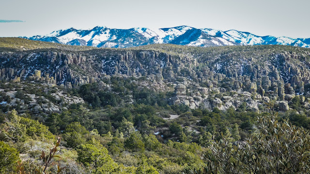
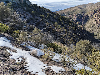
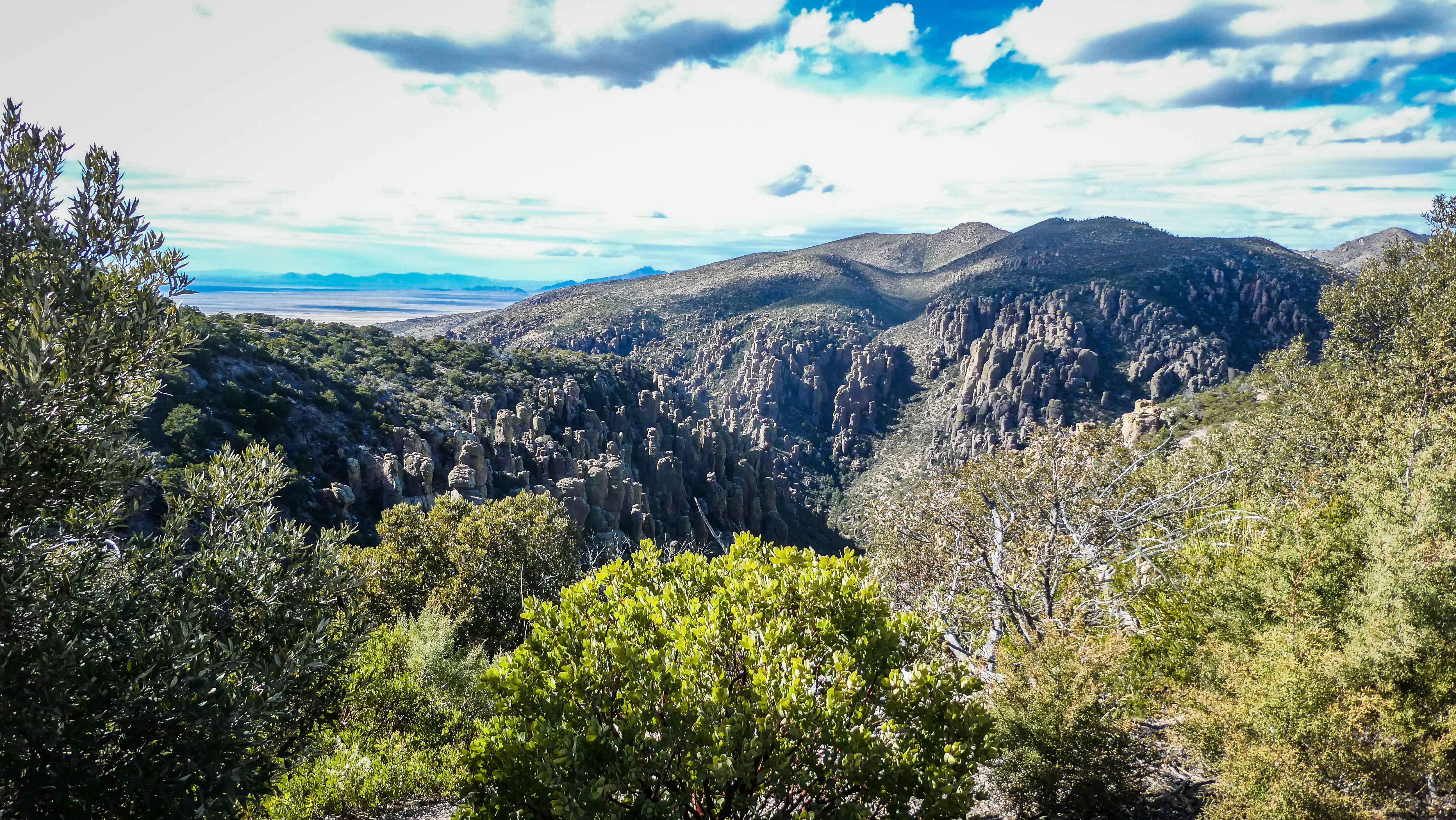
| Scott took this from his camera using the telephoto lens so you can see the distant snow capped mountains more clearly |
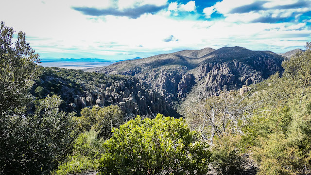 |
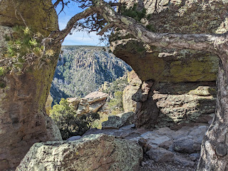
| Now nicknamed "Wonderland of Rocks", the Apache called it "The Land of Standing Up Rocks" |
 |
| We hiked the Nature Trail on top of the summit, Massai Point, our first afternoon. It's an 8 mile drive through fabulous scenery up to the top from the Visitor's Center. |
We learned a lot about Cochise, Geronimo and the Apache Wars on our visit to the Chiricahua National Monument! All new history to both of us. Why do we learn more about the Romans than our own forbearers? Well, especially not history concerning our indigenous people. The Apache tribes in this area had to first fight the Spanish and Mexicans as they intruded into their territory and then after the Mexican American War, the U.S. settlers who came to raise livestock and mine minerals. The spark for the war happened when American troops falsely accused Apache leader Cochise and his tribe of kidnapping a young boy. Despite Cochise's honest reply that it had not happened and his offer of help finding the boy, he was taken hostage. After his escape, several members of his family were executed and he swore revenge. What followed was a series of armed conflicts between the US Army and various Apache tribes fought between 1849 and 1886, although minor hostilities continued until as late as 1924. Cochise negotiated a peace treaty in 1872 and retired to the short lived Chiricahua Reservation before his death in 1874. Later the tribe was moved to Florida and ended up on the Trail of Tears. His son-in-law Geronimo continued the fight. It took over 5,000 soldiers to finally force the surrender of he and his last 24 men in 1886. There is a lot more about this in the rabbit hole named Wikipedia that I followed, fascinated by this period in our history. Delve into it and you will be too.
 |
| This is called Cochise's Profile and shows him lying down. He was secretly buried in this area and his grave has never been found. |
But, back to our trip. We started with an unexpected adventure. Our Google navigator sent us off the Interstate 10 at Bowie down the Apache Pass Rd, which soon turned into a narrow dirt road. I panicked but Scott assured me that this was the way. There were no signs for the Monument but only "Fort Bowie National Historic Site", which appeased me somewhat as the road had to be passable, right? Well, it was, but only just. We went 25 miles up and over a high pass. Only a small parking lot and a trail head for the 3 mile trek into the Fort's remains appeared during the one hour we spent on that road. What a relief to finally hit a paved route with a sign for the Monument.
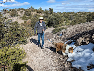 |
| Bob and his new Sheltie "Dandy" on the trail. |
 |
| There were patches of snow all along the top ridge |
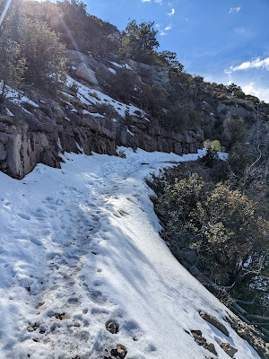 |
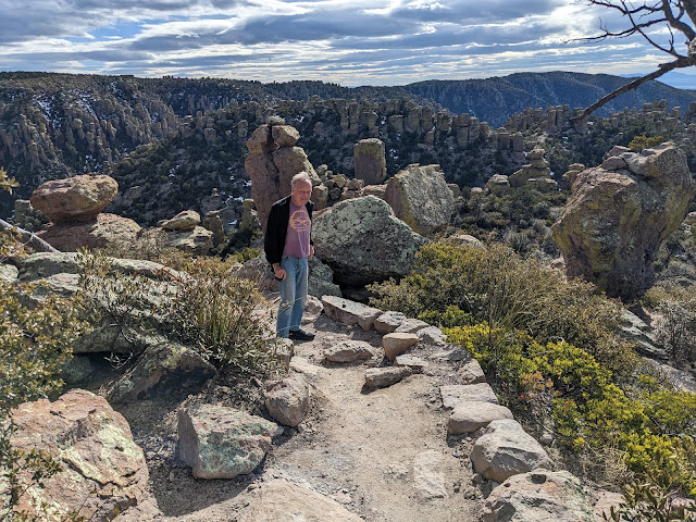
| This is where we decided to turn back |
We had made reservations at the Bonita Canyon Campground months in advance for both Bob and ourselves. Lesa didn't come - too bare bones (they have a camper van). The campsites were very nice, lots of trees and space between them. But it was a tight fit backing into ours' and took both Bob and Scott directing me to manage it. We headed right up to the Massai Point and had a beautiful but short hike. We thought about another trail but it quickly ended in snow. We didn't have the right foot gear for that. Back at the campground we celebrated with Bob's great Margaritas on the picnic table followed by my sausage and beef pasta and salad (and brownies).
The next morning after breakfast together on Bob's corned beef hash and eggs, we toddled back up to Massai Point to do the Nature Trail over to Echo Canyon. Halfway there Bob and Scott went back up to get the truck and drive it over to the trailhead and I continued on. Unfortunately as they discovered when they got there - I had the keys. So their hike turned out longer as they had to hike down the road to me.
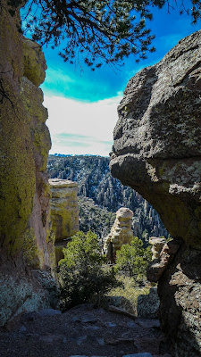 |
We hiked in and among the
standing rocks |
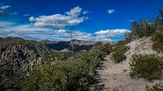 |
| The trails were easy to follow. |
 |
| And endlessly calling for one more photo! |
That afternoon we tried a different area going down to the Silver Spur Mountain Trail. Not long down that however we ran into a stream crossing that turned us around. No one wanted to take off their hiking boots and socks for the two crossings. So we continued down to the Bonita Creek Trail and that was perfect. It goes by the Faraway Ranch Historical Site and then later to the Stafford Homestead. The later was settled by Ja Hu and Pauline Stafford in 1879. Later in 1886 Swedish Immigrants Neil and Emma Peterson settled nearby at the Faraway Ranch. Both raised families in the area and in 1903 Neil became a Forest Ranger. Lillian, their oldest daughter, took over management of the Ranch and eventually took in paying guests until the late 1960's. She died on the Ranch in 1977. Both places are now Historical Sites and maintained as they were in their heyday. The trail winds up through grasslands along the brook with the mountains rearing up on both sides.
 |
| It was an easy trail past Faraway Ranch and the Stafford Homestead to the end where another stream crossing turned us back. |
It was another great meal sitting out on the picnic table. But first we had company for drinks. We had struck up a conversation with a couple from Maine that were in a RV next to us and invited them to join us. We had lots in common. They are sailors and work several times a year for Habitat for Humanity. Later we enjoyed my (pre-prepared) chicken, mushrooms and rice with salad for dinner. The next morning we packed up and headed behind Bob's Van to Green Valley where he and Lesa have bought a new home. More on that in my next post.
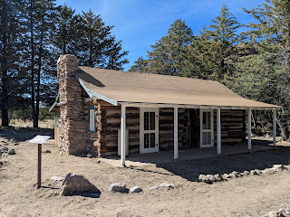 |
| The Stafford cottage |
 |
| Scott, Bob and Dandy at the Bonita Brook |
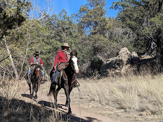 |
We shared this trail with equestrians. A lot of the
Parks out here allow horse and riders on many of
the trails. |


No comments:
Post a Comment